Entry Title
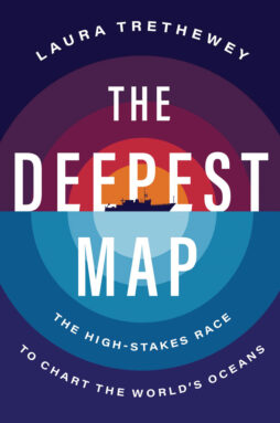
The Deepest Map
Laura Trethewey
Harper Wave, $32
In 2019, the multimillionaire and explorer Victor Vescovo made headlines when he became the first person to visit the deepest parts of all five of Earth’s oceans. But arguably the real star of the expedition was marine geologist Cassie Bongiovanni, the lead ocean mapper who ensured Vescovo piloted his submersible to the actual deepest depths.
Today, only 25 percent of the seafloor is well mapped. When Vescovo set out to score his record, the exact deepest location in each ocean was unknown. Bongiovanni, Vescovo and their crew had to chart these regions in detail before each dive.
“Traditionally, captains never cared about the seafloor as long as it stayed far enough away from the hulls of their ships,” journalist Laura Trethewey writes in The Deepest Map. The book explores humankind’s quest to map the seafloor, framed around Bongiovanni’s adventures.
Seafloor topography has been a big concern for militaries patrolling Neptunian frontiers with nuclear submarines and companies facilitating intercontinental communication via subsea cables (SN: 4/10/21, p. 28). In recent decades, seafloor data have become crucial to the deep-sea mining industries searching for metals needed to produce green technology.
Satellites have revealed many of the knobs and crevices visible in the deep blue of Google Maps. But with that relatively coarse information, entire mountains can be missed. To see the seafloor in high resolution requires a sophisticated sonar system aboard a big ship that sends sound signals from the sea surface into the abyss.
Mappers like Bongiovanni calculate depth from the time it takes for the signal to travel down and bounce back to the surface. These state-of-the-art sonar systems transform “the satellite-predicted blur into a sharp three-dimensional terrain of ripples, cracks and tears in the seafloor,” Trethewey writes. “The seafloor is ‘heard,’ rather than seen.”
Through Trethewey’s tale, she twines stories of tagging along with scientists and ocean mappers. That includes her inaugural adventure at sea, which a crew member noted was “pretty rough for a first-timer,” as he and Trethewey clung to a doorframe in near gale force winds. On this cruise aboard research vessel E/V Nautilus, which was surveying a poorly mapped stretch of California’s coast, Trethewey (and readers) are introduced to the art and science of seafloor mapping. On this day, Trethewey learned that mapping is especially difficult — and sometimes impossible — when the ocean is angry.
Trethewey’s insightful writing helps readers understand just why mapping the ocean — even in shallow coastal waters — is crucial to so many endeavors. She visits a remote Inuit village on the western bank of Canada’s Hudson Bay, where she joins hunters who map ever-changing coastlines for their own safety. Later, she scuba dives with archaeologists in Florida who use underwater maps to explore remnants of early human history that have been submerged for thousands of years.
A distant, possibly unreachable goal envisions creating a complete map of the entire seafloor by the end of this decade, an effort known as Seabed 2030. Because the oceans are vast and replete with remote and dangerous places that people simply can’t or shouldn’t go, this effort will almost certainly require autonomous surface vehicles armed with sonar. Such devices are already probing the depths and sending back data.
Staring at computer screens in a sun-filled conference room, Trethewey watches as a drone outfitted with cameras, environmental sensors and a sonar system maps a bit of seafloor off California as she sips her coffee. “The future of ocean mapping weirdly felt a lot like checking social media or doing anything else on your phone these days,” she wryly observes.
Trethewey’s book is about more than just mapping the oceans. It’s also about what can go wrong when explorers explore. It’s hard to read The Deepest Map without being reminded of the recent implosion of the Titan submersible in the North Atlantic that killed everyone on board in June. Indeed, Trethewey describes how, during Vescovo’s first solo dive, his colleagues endured 25 minutes of apprehension-turned-alarm when they didn’t hear from him.
She also reminds us how easily exploration can turn into exploitation. In the not-so-distant past, Europeans “discovered” the so-called New World and mapped it, Trethewey writes. Exploitation followed. Scientists and environmentalists alike are now concerned that a full, detailed map of the ocean floor might lead to the destruction of delicate, mostly unknown habitats if deep-sea miners are allowed to extract metals.
Trethewey envisions a different outcome. Seabed 2030’s mapping effort may help people see that “the weird, wonderful deep-sea world is not a blank space, another frontier to use up and throw away,” and should be safeguarded for scientists “to uncover our past and protect our future.”
Buy The Deepest Map from Bookshop.org. Science News is a Bookshop.org affiliate and will earn a commission on purchases made from links in this article.
from Science News https://ift.tt/LS4olKH
via

Comments
Post a Comment